

Freestone · Mixed · Montana, US

Madison River

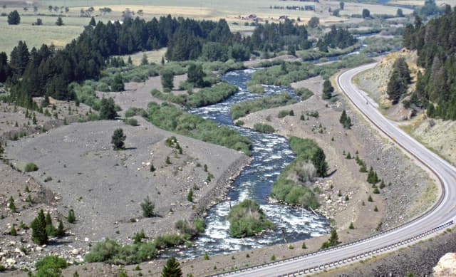
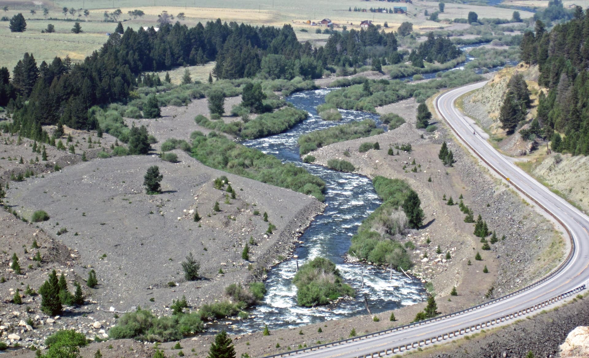
Madison River (just downstream from the Madison Landslide, Madison County, Montana, USA)
Today · A proper day on the water
Sculpin Streamer
Forecast · Today
A proper day on the water
A proper day for it. Work the seams with an upstream nymph, switch to the dry when they show.
75% projected
Today's fly
Sculpin Streamer
Sculpin Streamer
Conditions on the water · Today
Live gauge
Level
Falling
0.47 m
Dropping after lift
Water temp8.6°C
ClarityClearing
Weather9°C
WindN 14 km/h
Pressure1024 hPa
Rain · recent0.0 mm
Rain · ahead0.0 mm

The nearest gauge doesn't record temperatures, so we've estimated it — defer to the river keeper's advice.

Water temperature for Brown Trout
Cool — slow
9°C est.ideal 10–16°C
0°14°28°
How to fish it · for Brown Trout
When
Nymphing can work through most of the day.
Where
Cover mixed depths.
Method
Start with tight-line nymphs and adjust if fish rise or drift higher.
Kit
9 ft #4 rod, floating line, 12 ft tapered leader to 4–5 lb fluoro tippet.
Why this works
Good — water clarity is right today, though insect activity could be better.
Likely species
Hatch timeline · todayPeak at 11 Uhr

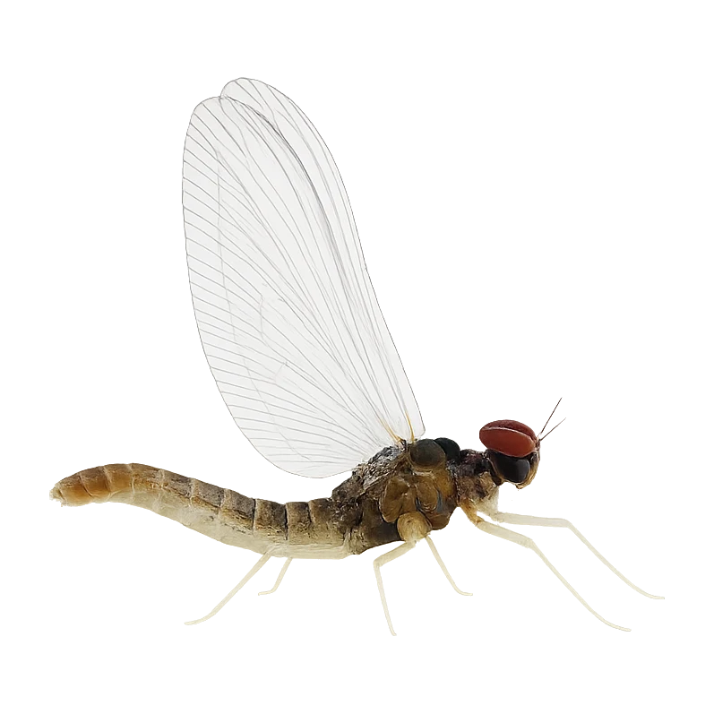
12 Uhr(now) — Western Blue-Winged Olive

Stage: On emergersApproach: Emerger or dryActivity: 32%
Also:Black Midge29%
Peak emergence window5 food groups active

Peak activity at 11 Uhr — Western Blue-Winged Olive (Western Blue-Winged Olive, Peak emergence window)

Sub-surface · on the nymphunder the surface

Hatch predictions

Supporters see the full sub-surface read.

Start free trial

14-day free trial. Cancel anytime.

Beyond the hatch · worth watchingambient prey(1)

Hatch predictions

Top prey shown — see all 2 as a supporter.

Start free trial

14-day free trial. Cancel anytime.

Evidence
Records-basedModerate confidence

Based on species-occurrence records, not local invertebrate surveys.

Through the year
0–3 scale · October highlighted
J
F
M
A
M
J
J
A
S
O
N
D
Trout seasonSeason
2
1
1
2
2
2
2
2
2
2
Brown DunHatch
2
3
3
3
3
3
3
2
Western Green DrakeHatch
2
2
Flav (Small Western Green Drake)Hatch
2
3
2
Mahogany DunHatch
2
2

Numbers are intensity 0 (none) to 3 (peak) — a guide, not a guarantee.

Ranked for today
Fly box · Brown Trout
SD
Sex Dungeon
2-6 · Pattern
Proven pattern for this period
Beats · 7 · 6 reaches

The Madison isn't one fishery — it's a chain of very different reaches running from the Yellowstone Park headwaters, through the Hebgen-to-Quake lakes country, down the famous 50-mile riffle of the Upper Madison, across the walk-wade channels above Ennis, through Bear Trap Canyon below Ennis Dam, and out onto the Lower Madison toward the Missouri. Almost all of it is public water fished on a Montana license, and Montana's stream-access law keeps you legal below the high-water mark even where the bank is privately owned — but that doesn't mean you can cross private land to reach it. Above Ennis especially, a lot of the frontage is ranchland, so plan to get in through FWP fishing access sites, not by walking across someone's field. Rules change reach by reach: the Park has its own season and species handling, and one stretch above Ennis is walk-wade only with fishing from a boat flat-out prohibited. And this is heat-sensitive country. In a low, warm summer the Madison goes under hoot-owl restrictions (no fishing 2pm to midnight) or full closures, especially the Lower Madison and the Park water — always check the current Montana FWP restrictions and Yellowstone regulations before you fish.

Madison River — Yellowstone National ParkPublic
The headwater Madison inside Yellowstone, formed where the Firehole and Gibbon meet at Madison Junction and running west to the park boundary near West Yellowstone.
Madison River — Between the LakesPublic
The short, famous reach of river between Hebgen Lake and Earthquake (Quake) Lake.
Upper Madison — the 50-mile riffle (Quake Lake to Varney)Public
The heart of the Madison — the continuous, boulder-studded "50-mile riffle" running from the Quake Lake outlet down past Raynolds Pass, Three Dollar Bridge, Lyons Bridge, Palisades, McAtee and on to Varney.
Ennis channels (walk-wade) · 2 beatsDay rods
Madison River — Ennis channels (walk-wade only), Ennis Lake
The 2 beats
Madison River — Ennis channels (walk-wade only)Public
Montana FWP / public-private mix
The braided, shallow channels where the Upper Madison spreads out below Ennis and runs into Ennis Lake. This is distinctive walk-wade water — and there's a hard rule here: fishing from a boat is prohibited from the Ennis Fishing Access Site down to Ennis Reservoir. It's also shallow and warm-water-prone in late summer, so it's an early-and-late, cool-day reach.
FISHING FROM A BOAT IS PROHIBITED from the Ennis Fishing Access Site to Ennis Reservoir — this is a walk-wade-only stretch; you may float through but not fish from the boat. Public access is mainly at Ennis Bridge and Valley Garden FAS. The shallow braided channels warm quickly in late summer — watch water temperature for trout welfare and expect hoot-owl restrictions when it's low and hot. Verify the current FWP recreation rules for this section.
Ennis LakePublic
Montana public access / private frontage
The shallow impoundment that splits the Upper and Lower Madison. Listed here for context, not as a primary fly-river reach — it warms badly in summer and its main role on this page is structural: it separates the two halves of the river and drives the temperature of everything below it. If it's fished as a stillwater venue, that belongs on its own lake entry, not here.
Structural / context entry only — Ennis Lake is a warm, shallow impoundment, not a recommended trout-river reach. Its summer heating is part of why the Lower Madison below it runs warm and goes to hoot-owl restrictions. Confirm access and any stillwater regulations separately if a lake venue is added.
Madison River — Bear Trap CanyonPublic
The heavy, pushy canyon water below Ennis Dam, running through BLM wilderness-study land in a granite gorge.
Lower Madison — Warm Springs to the Missouri confluencePublic
The lower-gradient river below Bear Trap Canyon, running from the Warm Springs BLM day-use area down past Black's Ford and Greycliff toward the Missouri confluence near Three Forks.
Permits & access
Permit required — see local rules.
  • Montana licence
  • Check FWP for the West Yellowstone / Quake Lake special regulations and in-season hoot-owl (2pm–midnight) closures in low, warm years.
What's coming
Plan ahead
5-day outlook
Other water nearby · 5
Gallery · 2
  1. Madison River (just downstream from the Madison Landslide, Madison County, Montana, USA)
  2. Terrain map of the venue
    Terrain map
Water quality · US Clean Water Act
  • Aquatic life: Not assessed
What this classification means

EPA ATTAINS assessment unit 'Madison River' (MT41F001_020), 2021 Integrated Report. Aquatic Life use: Insufficient Information. Listed impairment causes: Metals Other Than Mercury. This is a Clean Water Act assessment-unit classification (the US analogue of WFD), not a live reading.

Status is for the Clean Water Act assessment unit covering this reach.

EPA ATTAINS (Clean Water Act) · MT41F001_020

The full read · show the working · for Brown Trout · confidence 90%
How the 75 is built — score × weight = contribution
Temperature62 × 28%17.4
Flow80 × 22%17.6
Clarity95 × 18%17.1
Feeding Time80 × 13%10.4
Pressure80 × 7%5.6
Insect activity61 × 12%7.3
Conditions total= 75
Can you trust it?
Water temperaturelive gauge readinggauge
Level / flowon-river gaugeobserved
Prey activitymodelled from regional profilemodelled
What would change the calculation
Warmer water — toward the 10–16 °C ideal band — would lift the temperature score.
Directions
Seasons & zones
  • Trout Dritter Saturday im May → Letzter day of February
Related guides
Booking & contacts