Spate · Slate · Asturias/Galicia, Spain

Río Eo

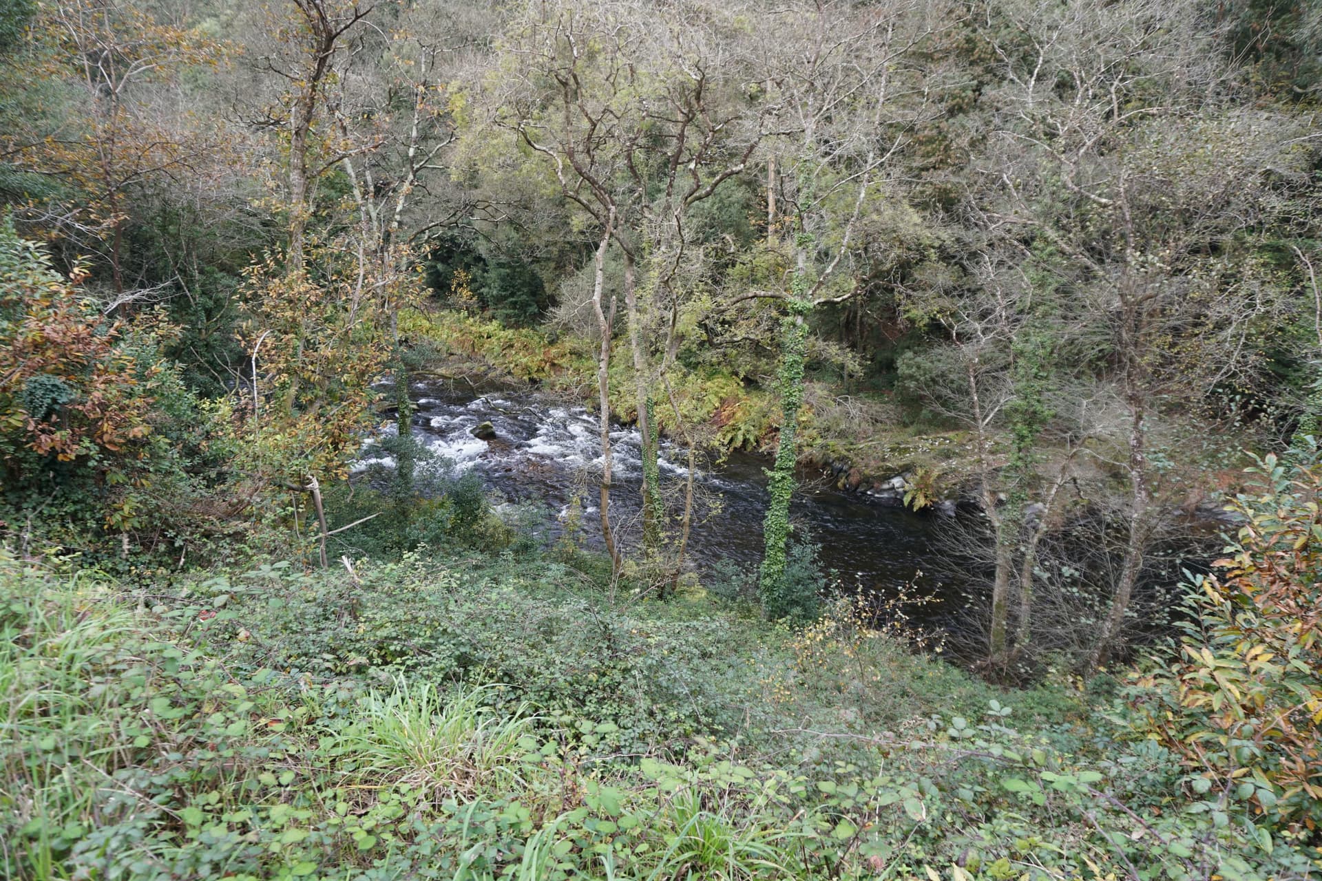
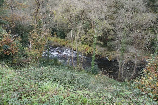
The Río Eo viewed from the Vía Verde greenway on the Galicia–Asturias border.

The Eo was until recently a classic Atlantic salmon and sea trout river forming the traditional border between Asturias and Galicia, flowing 81 km from the interior slate moorlands to the beautiful ría at Ribadeo.

Today · Not the day for it
Small Chironomid
Forecast · Today
Not the day for it
Not much stacked in your favour today. Worth an hour if you are nearby, not worth the special trip.
45% projected
Today's fly
SC
Small Chironomid
Conditions on the water · Today
Live gauge
Level
Rising
0.30 m
lowspate
Water temp4.6°C
ClarityUnfishable
Weather9°C
WindN 14 km/h
Pressure1013 hPa
Rain · recent36.2 mm
Rain · ahead15.1 mm

The nearest gauge doesn't record temperatures, so we've estimated it — defer to the river keeper's advice.

Water temperature for Brown Trout
Cool — slow
5°C est.ideal 10–16°C
0°14°28°
How to fish it · for Brown Trout
When
Slate water keeps an amber tint that suits dry-fly to within an hour of last light. Through the open trout season — March in zonas libres, May onwards in salmon zones.
Where
Step-pool sequences in the upper reaches; the middle Eo settles into pool-riffle on slate cobble. Watch the slabs — good lies for trout, treacherous wading underfoot.
Method
Dry to risers in the long glides, short-line nymph through the step-pools and pocket water. Slate water reads darker than limestone — a smaller, drabber pattern works better than the bright stuff that fishes on the Sella.
Kit
9 ft #4 upper, 9 ft #5 middle. Floating line, 12 ft leader to 4 lb fluoro. Slate slabs look secure and aren't — wading staff.
Why this works
Poor — water clarity is working for you, but water temperature is the limiting factor today.
Hatch timeline · todayQuiet day

12pm(now) — Autumn Needle Fly

Stage: Creeping nymphsApproach: Heavy nymphActivity: 17%

Low insect activity predicted today

Sub-surface · on the nymphunder the surface

Hatch predictions

Top nymph shown — see all 2 guilds as a supporter.

Start free trial

14-day free trial. Cancel anytime.

Evidence
Survey-backed · regionalHigh confidence

Backed by regional invertebrate surveys; no sampling on this exact reach yet.

Through the year
0–3 scale · November highlighted
J
F
M
A
M
J
J
A
S
O
N
D
Salmon runRun
1
2
2
1
Trout seasonSeason
1
2
2
2
2
1
March BrownHatch
2
3
2
Late March BrownHatch
2
3
2
Large Brook DunHatch
2
3
2
Large StoneflyHatch
2
3
2

Numbers are intensity 0 (none) to 3 (peak) — a guide, not a guarantee.

Ranked for today
Brown Trout fly box
SC
Small ChironomidTop
22–24 · Pattern
Upstream dry, on top
Beats · 6
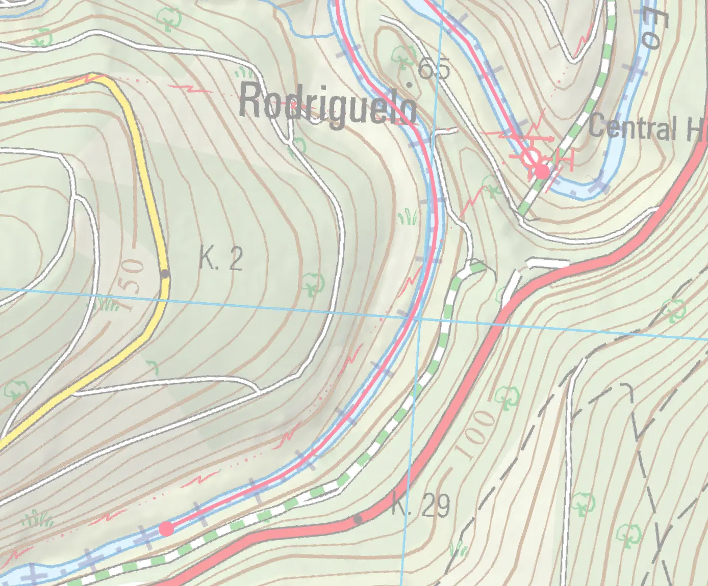
Cairo · 1.7 kmSorteo
Sorteo stretch — Puente Traslacorde to Frente cruce de carretera Vilaoruz-Foxas.
Beat detail
Sorteo (lottery) permit required
Upstream: Puente Traslacorde
Downstream: Frente cruce de carretera Vilaoruz-Foxas
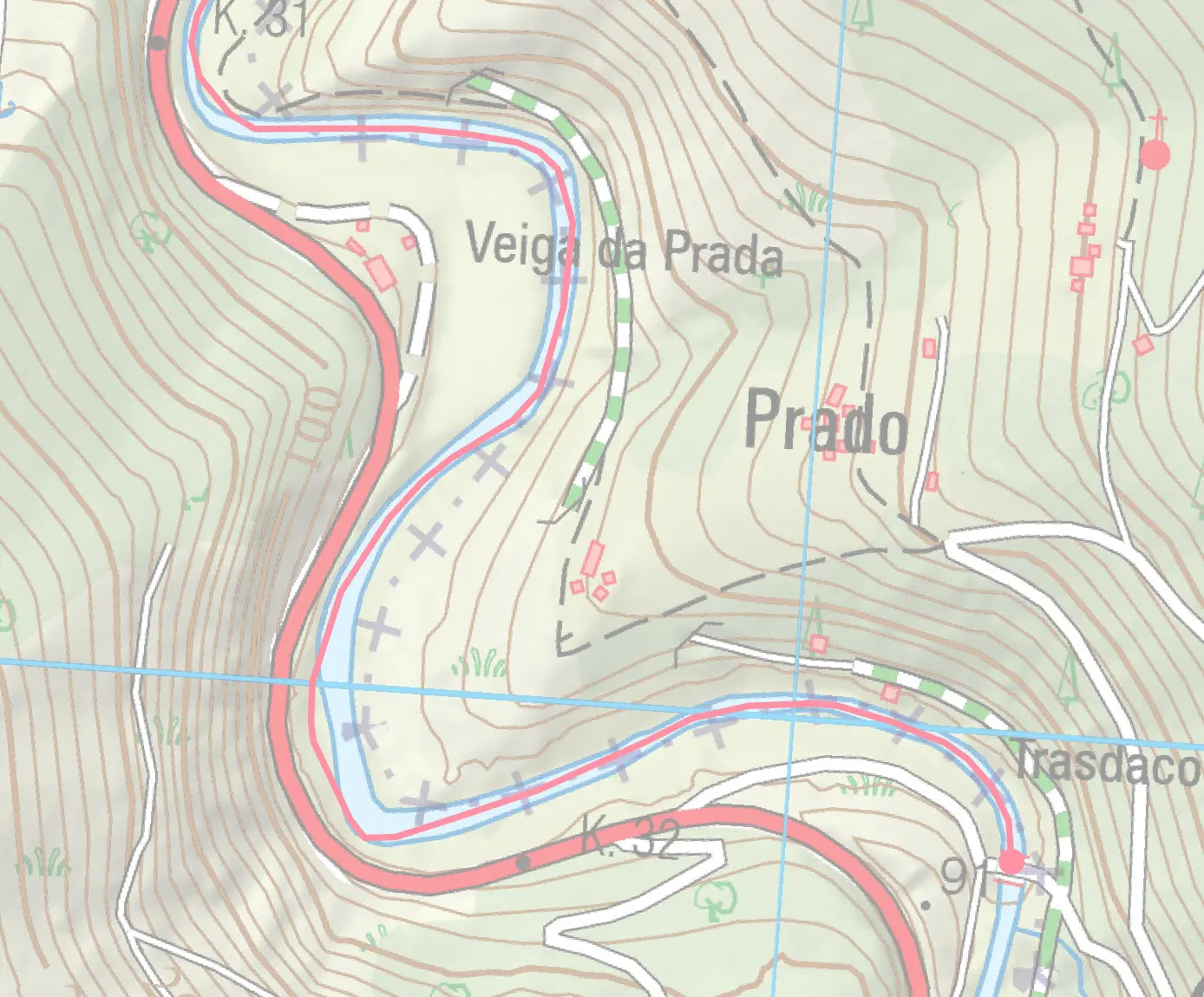
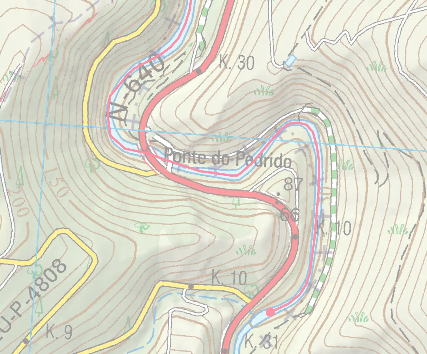
Cairo beat map
Pedrido · 1.5 kmC&R
C&R stretch — Frente cruce de carretera Vilaoruz-Foxas to 50 m aguas arriba de la presa de Saltadoiro.
Beat detail
Sorteo permit, all fish returned
Upstream: Frente cruce de carretera Vilaoruz-Foxas
Downstream: 50 m aguas arriba de la presa de Saltadoiro
Pedrido beat map
Estreitos · 1.5 kmSorteo
Sorteo stretch — Pozo de Estreitos 200 m aguas abajo de la pasarela de Piagomayor to Puente del ferrocarril.
Beat detail
Sorteo (lottery) permit required
Upstream: Pozo de Estreitos 200 m aguas abajo de la pasarela de Piagomayor
Downstream: Puente del ferrocarril
Estreitos beat map
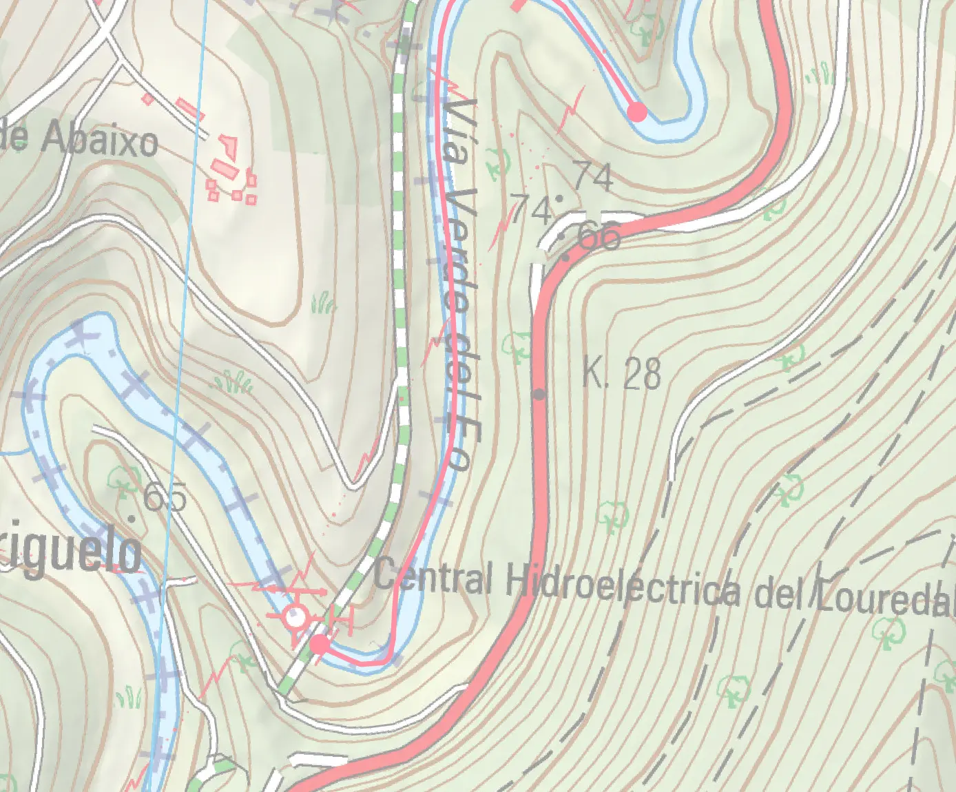
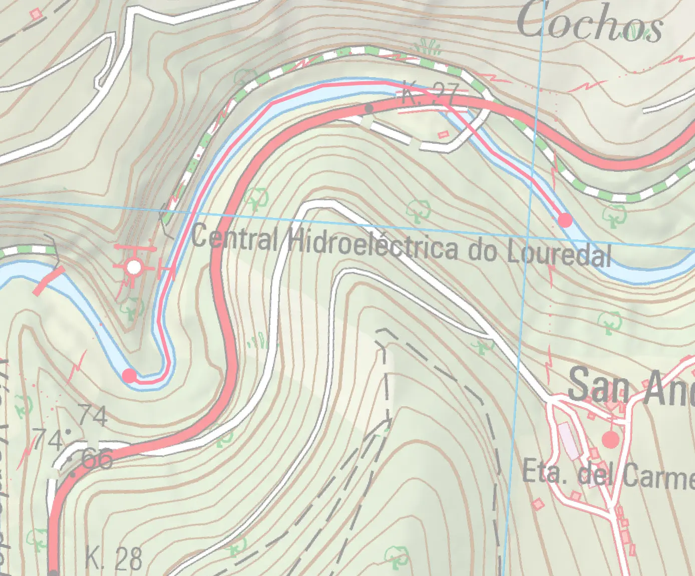
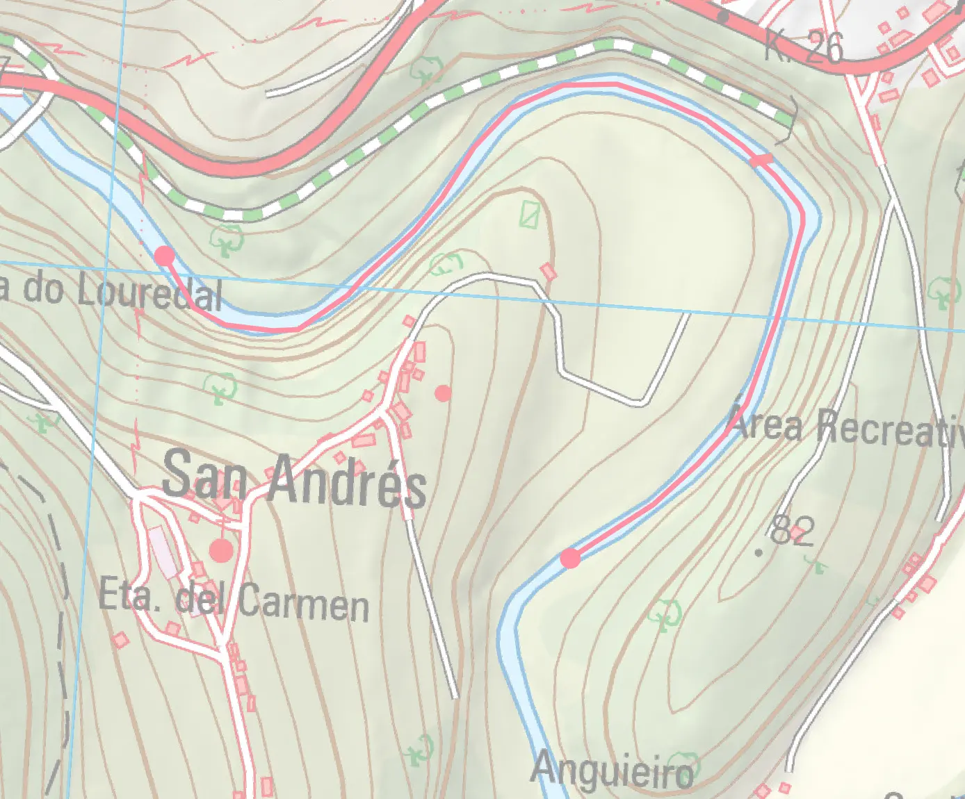
Louredal · 1.0 kmSorteo
Sorteo stretch — Puente del ferrocarril to Pasarela de la Volta.
Beat detail
Sorteo (lottery) permit required
Upstream: Puente del ferrocarril
Downstream: Pasarela de la Volta
Louredal beat map
Volta · 1.0 kmFree Tue/Wed/Sat
Free Tue/Wed/Sat stretch — Pasarela de la Volta to Cabecera pozo Vixato, 150 m aguas abajo del puente La Negra.
Beat detail
Free on Tue/Wed/Sat, sorteo on other days
Upstream: Pasarela de la Volta
Downstream: Cabecera pozo Vixato, 150 m aguas abajo del puente La Negra
Volta beat map
Gonzalvo · 1.3 kmSorteo
Sorteo stretch — Cabecera pozo Vixato to Anguieiro cabecera pozo Florentino.
Beat detail
Sorteo (lottery) permit required
Upstream: Cabecera pozo Vixato
Downstream: Anguieiro cabecera pozo Florentino
Gonzalvo beat map
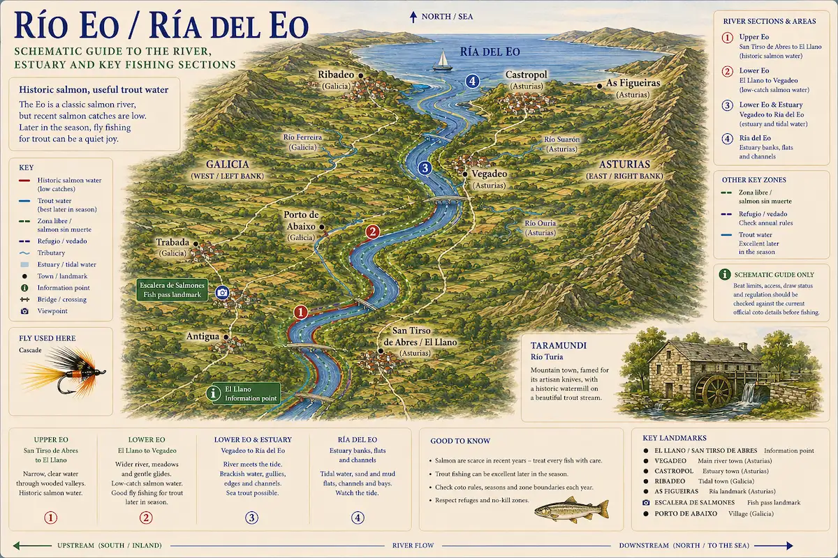
Beat map
Illustration · Studio Daisy
Beat map — illustrated schematic
Eo system from headwaters to Ría del Eo estuary. Schematic — verify zone status annually.
Permits & access
Free state water
State rod licence required for trout / salmon as applicable.
  • Sorteo (lottery) beat allocation via Federación Asturiana de Pesca
  • Licencia de pesca + permiso de coto required
  • For 2026, salmon cupo is 1 fish per day and 1 per season, of which only 1 may be killed
  • Check river-specific coto rules, vedados, and tackle restrictions before fishing.
What's coming
Plan ahead
5-day outlook
Fishing better nearby · 5
Gallery · 6
  1. The Río Eo viewed from the Vía Verde greenway on the Galicia–Asturias border.
    Río Eo from the Vía Verde
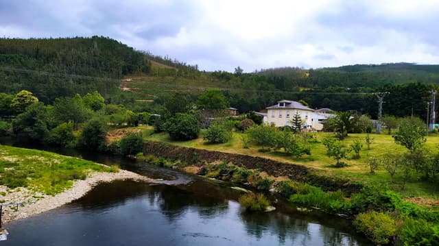
  2. The Eo flowing through A Pontenova, Galicia, with wooded valley banks in autumn light.
    Río Eo at A Pontenova
  3. The Eo along the riverside walk at A Pontenova, Galicia, in summer.
    Río Eo riverside at A Pontenova
  4. The Eo at the Cortevella recreational area in Baleira, Galicia, with a footbridge and riparian woodland.
    Río Eo at Baleira
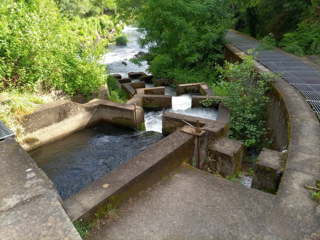
  5. The salmon ladder at the Pé da Viña dam on the Río Eo near Trabada, Galicia.
    Salmon ladder at Pé da Viña, Río Eo
  6. Terrain map of the venue
    Terrain map
About this water

The river's character is pure Atlantic spate — narrow, tumbling upper reaches; productive middle-section cotos; and tidal lower reaches that concentrate salmon and sea trout. The Eo's slate geology creates distinctive dark, polished pools and fast rocky runs with excellent salmon-holding characteristics. Spring and early summer (May–June) bring salmon runs; late June and July see a transition to sea trout and brown trout. The river responds quickly to rainfall (6 hours) due to its compact catchment, making it an excellent choice for weather-dependent fly-fishing tactics. Coto beats are allocated via the regional sorteo; Fishing techniques range from dry fly on summer low water to heavy spey casting in spring flood. The Eo's lower reach is tidal — salmon hold in the estuary and run during high water; timing is critical. Sea trout anglers fish evening tide with small flies (sizes 10–14). The river fishes best gauge readings of 0.8–1.5 m. Ribadeo offers excellent accommodation and dining; local tackle shops provide up-to-date river reports. Atlantic salmon stocks are under serious conservation pressure, and the 2026 cupo is tightly limited — one salmon per angler per year may be killed; any further fish must be released.

Under the surface

The Eo marks the boundary between Asturias and Galicia, running roughly 52 kilometres from the slate and quartzite Cantabrian headwaters down through western valleys to the sea at Castropol. The upper reaches are step-pool and partly confined on mixed slate and quartzite; the geology gives the water that amber tone, the kind of colour that follows slate everywhere. The middle Eo settles into pool-riffle sequences on well-sorted cobble emerging from the slate. The river is responsive — the Cantabrian rainfall means it can peak and return quickly — and the pool sequences shift position with the seasons. Lower reaches flatten toward the estuary. The Eo marks a boundary not just politically but in landscape character; you feel the shift from eastern Asturias's dramatic limestone into the moodier slate-country character that belongs to Galicia. Watch the slate slabs in the upper sections — they offer good fishing and treacherous wading.

Wading: Algal coated slate slabs at step lips

  • Slate
  • Partly confined
  • Step pool
  • Pool riffle
Water quality (WFD)
  • Ecology: Good
  • Chemical: Unknown

WFD classification · ES018MSPFES244MAR002280

The full read · show the working · for Brown Trout · confidence 55%
How the 38 is built — score × weight = contribution
Temperature19 × 28%5.3
Flow60 × 22%13.2
Clarity95 × 18%17.1
Feeding Time75 × 13%9.8
Pressure80 × 7%5.6
Insect activity31 × 12%3.7
Limiting factor: Water temperature (4.6°C) is outside Brown Trout's preferred range (10–16°C)= 55
Can you trust it?
Water temperatureair-to-water estimateestimated
Level / flowon-river gaugeobserved
Prey activitysurvey-backed invertebrate datasurvey
What would change the calculation
Warmer water — toward the 10–16 °C ideal band — would lift the temperature score.
Directions
Seasons & zones
  • Trout Third Sunday of March → 15 August
4 zones — different rules apply
  • Coto salmonero

    Main Eo salmon beats: Cairo, Estreitos, Louredal, Gonzalvo, La Peña, Reiboa, Louside, Las Barcas, El Carbayón, Pozón, Canabeiras — most shared with Galicia

    • Salmon: Third Saturday of April → 15 July · 1 per day, 1 per season (kill limit)
    • Sea trout: follows Trout
    • Trout: Third Sunday of May → 31 July
  • Coto salmonero sin muerte

    Pedrido sin muerte beat (shared with Galicia)

    • Salmon: Third Saturday of April → 15 July
    • Sea trout: follows Trout
    • Trout: Third Sunday of May → 31 July
  • Coto parcial

    Volta coto parcial — middle river

    • Salmon: Third Saturday of April → 15 July · 1 per day, 1 per season (kill limit)
    • Sea trout: follows Trout
    • Trout: Third Sunday of March → 31 July
  • Zona libre

    Non-coto stretches of the Eo — free-access trout water

    • Sea trout: follows Trout
    • Trout: Third Sunday of March → 31 July

Sea trout: Variable seasonal (2026) — Eo — the Galicia-Asturias border river. Reo and salmon fishery with regulatory complexity (both regional administrations). Sea trout run from the estuary on rising water. Condition-sensitive; regulated access. Night fishing rules vary by bank (Galician vs Asturian side).

Salmon: Heritage only (2026) — Heritage Asturian salmon river — was classic Atlantic salmon and sea trout water until recent decades, now with negligible salmon runs. Listed as 'historic' to acknowledge identity without promoting salmon fishing. Brown trout and (limited) sea trout remain of interest.

Related guides
Booking & contacts
At a glance

Río Eo is a spate river in Asturias/Galicia, Spain — Border river to Ribadeo. Its recorded elevation is about 826 m above sea level and the catchment geology is slate. The river is described as roughly 81 km long. Our data lists brown trout, sea trout and salmon here. It is classed as a salmon river. The salmon season is recorded as running from Third Saturday of April to 15 July. The trout season is recorded as running from Third Sunday of March to 15 August. Best window recorded for anglers: May–July (salmon peak); March–April (spring runs). Core methods listed: dry fly (low water); small tube fly; wet fly for sea trout. Level and flow data for this water is linked from 4 gauges. Its Water Framework Directive ecological status is recorded as good. Access is recorded as free public fishing under the regional rules. Nearby waters in our listings include Río Suarón at 15 km, Río Porcía at 27 km and Río Masma at 29 km.