

Freestone · Mixed · Montana

Madison River

Madison River venue image

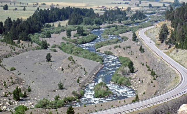
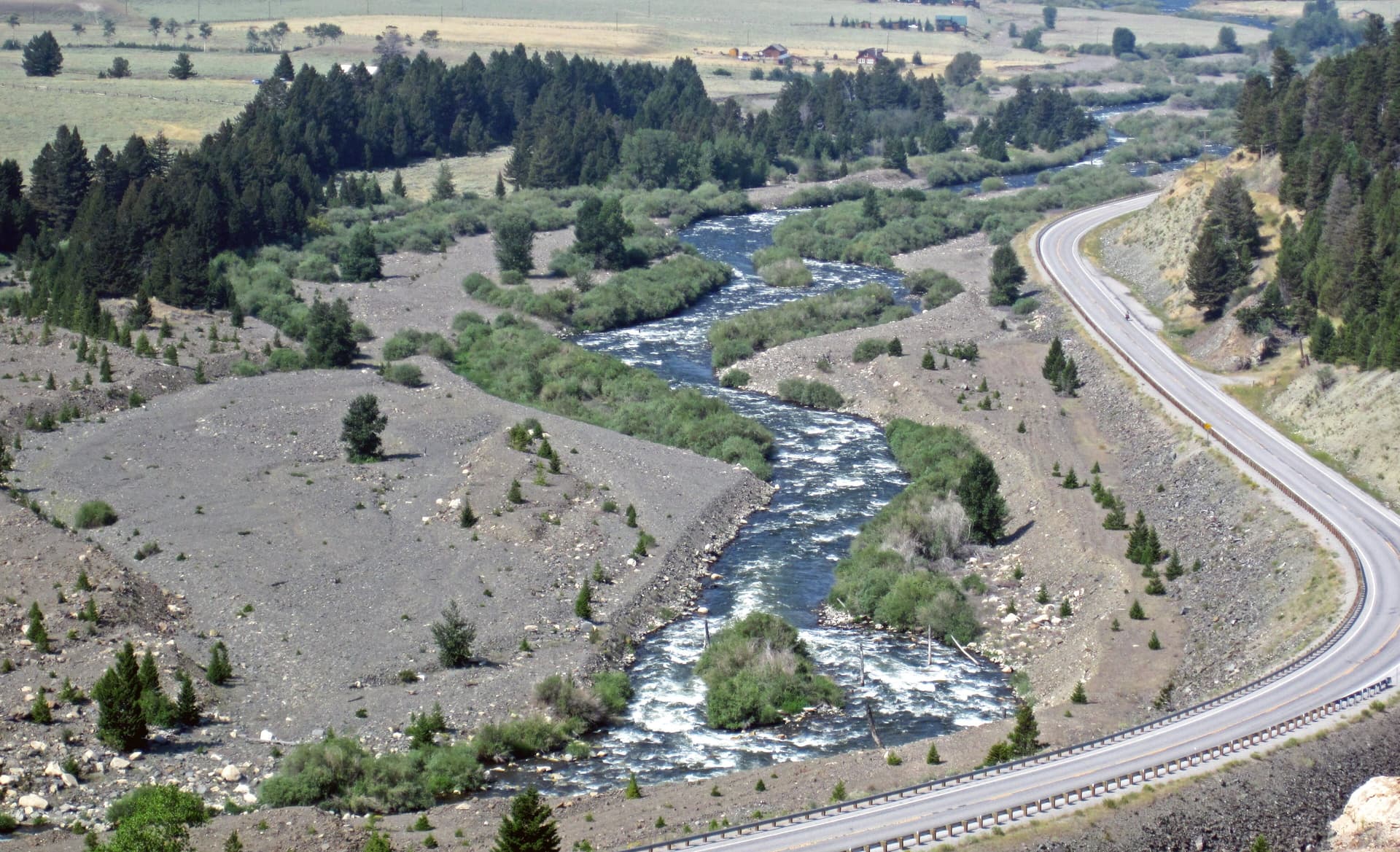
The Madison is the Greater Yellowstone freestone everybody pictures — a long, even-tempered riffle you can wade most of, famous for its summer salmonfly hatch and a steady run of caddis.

Prime · Brown Trout
Parachute Adams · 12-18
Primelive now
About as good as it gets
River dropping into shape after a lift. The kind of afternoon you remember — a weighted nymph through the clearing seams, the dry as it settles.
90% confidence
What moved it
  • Level0.56 mDropping after lift
  • Water temp16.3°C
  • ClarityClear
Today's fly
Parachute Adams
Parachute Adams12-18
High-confidence seasonal pick
Conditions on the water
Live gauge
Level
Steady
0.56 m
Dropping after lift
Water temp16.3°C
ClarityClear
Weather26°C
WindSE 10 km/h
Pressure1016 hPa
Rain · recent1.3 mm
Rain · ahead0.0 mm

Live readings only. Trends shown where the gauge supports them.

Water temperature for Brown Trout
Warm — slow
16.3°Cideal 1016°C
0°14°28°
How to fish it · for Brown Trout
When
Nymphing can work through most of the day.
Where
Cover mixed depths.
Method
Start with tight-line nymphs and adjust if fish rise or drift higher.
Kit
9 ft #4 rod, floating line, 12 ft tapered leader to 4–5 lb fluoro tippet.
Why this works
Excellent — water clarity is right today, though insect activity could be better.
Hatch timeline · todayQuiet day

Hatch predictions

Today's headline hatch shown — see all 5 active hatches hour by hour with Pro.

Start free trial

14-day free trial. Cancel anytime.

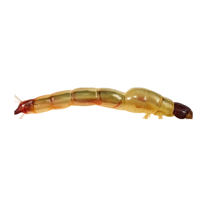
Sub-surface · on the nymphunder the surface

Hatch predictions

Top nymph shown — see all 2 guilds with Pro.

Start free trial

14-day free trial. Cancel anytime.

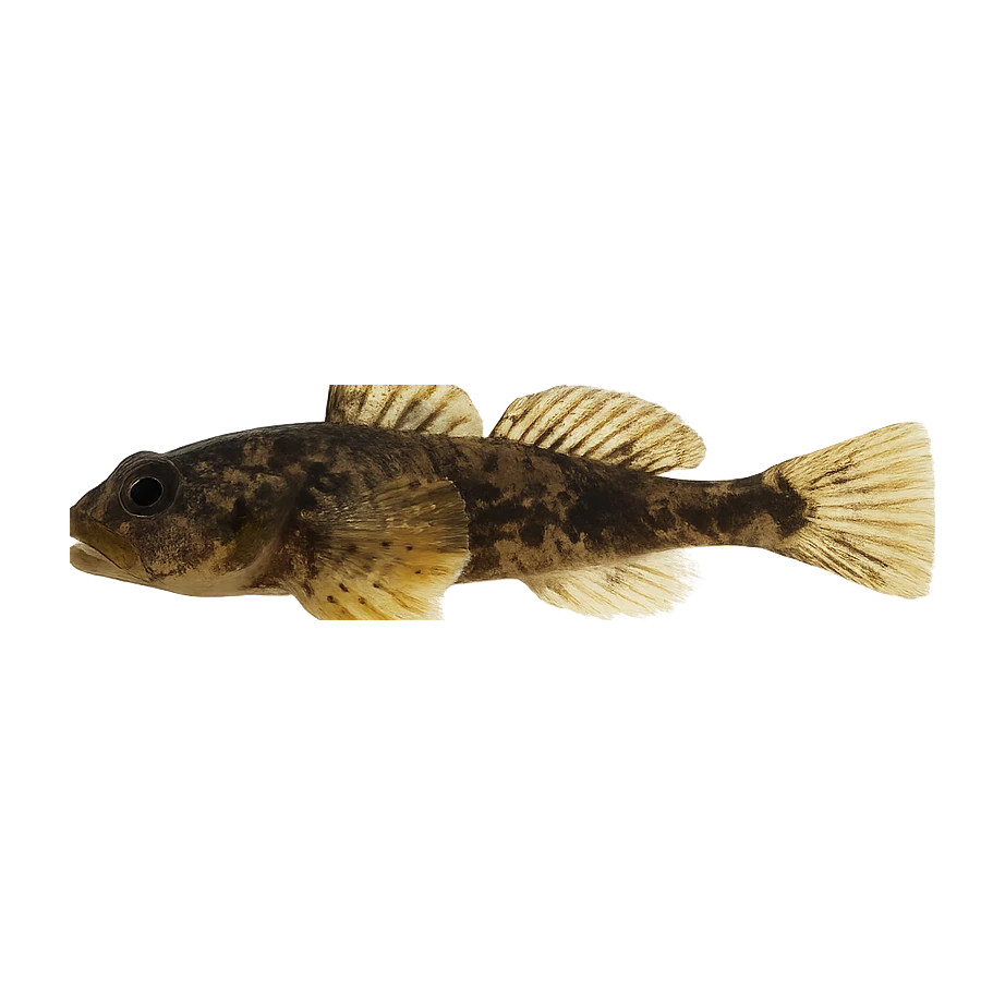
Beyond the hatch · worth watchingambient prey

Hatch predictions

Top prey shown — see all 2 with Pro.

Start free trial

14-day free trial. Cancel anytime.

Evidence
ModelledModerate confidence

Modelled from regional ecology — no survey or occurrence data for this water yet.

Through the year
0–3 scale · July highlighted
J
F
M
A
M
J
J
A
S
O
N
D
Trout seasonSeason
2
1
1
2
2
2
2
2
2
2
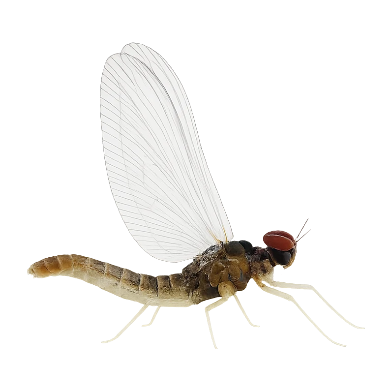
Western Green DrakeHatch
2
2
Flav (Small Western Green Drake)Hatch
2
3
2
Mahogany DunHatch
2
2
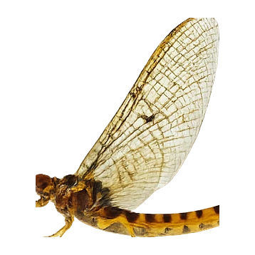
American March BrownHatch
2
3
2

Numbers are intensity 0 (none) to 3 (peak) — a guide, not a guarantee.

Ranked for today
Brown Trout fly box
Beats · 7 · 6 reaches

The Madison isn't one fishery — it's a chain of very different reaches running from the Yellowstone Park headwaters, through the Hebgen-to-Quake lakes country, down the famous 50-mile riffle of the Upper Madison, across the walk-wade channels above Ennis, through Bear Trap Canyon below Ennis Dam, and out onto the Lower Madison toward the Missouri. Almost all of it is public water fished on a Montana license, and Montana's stream-access law keeps you legal below the high-water mark even where the bank is privately owned — but that doesn't mean you can cross private land to reach it. Above Ennis especially, a lot of the frontage is ranchland, so plan to get in through FWP fishing access sites, not by walking across someone's field. Rules change reach by reach: the Park has its own season and species handling, and one stretch above Ennis is walk-wade only with fishing from a boat flat-out prohibited. And this is heat-sensitive country. In a low, warm summer the Madison goes under hoot-owl restrictions (no fishing 2pm to midnight) or full closures, especially the Lower Madison and the Park water — always check the current Montana FWP restrictions and Yellowstone regulations before you fish.

Madison River — Yellowstone National ParkPublic
The headwater Madison inside Yellowstone, formed where the Firehole and Gibbon meet at Madison Junction and running west to the park boundary near West Yellowstone.
Madison River — Between the LakesPublic
The short, famous reach of river between Hebgen Lake and Earthquake (Quake) Lake.
Upper Madison — the 50-mile riffle (Quake Lake to Varney)Public
The heart of the Madison — the continuous, boulder-studded "50-mile riffle" running from the Quake Lake outlet down past Raynolds Pass, Three Dollar Bridge, Lyons Bridge, Palisades, McAtee and on to Varney.
Ennis channels (walk-wade) · 2 beatsDay rods
Madison River — Ennis channels (walk-wade only), Ennis Lake
The 2 beats
Madison River — Ennis channels (walk-wade only)Public
Montana FWP / public-private mix
The braided, shallow channels where the Upper Madison spreads out below Ennis and runs into Ennis Lake. This is distinctive walk-wade water — and there's a hard rule here: fishing from a boat is prohibited from the Ennis Fishing Access Site down to Ennis Reservoir. It's also shallow and warm-water-prone in late summer, so it's an early-and-late, cool-day reach.
FISHING FROM A BOAT IS PROHIBITED from the Ennis Fishing Access Site to Ennis Reservoir — this is a walk-wade-only stretch; you may float through but not fish from the boat. Public access is mainly at Ennis Bridge and Valley Garden FAS. The shallow braided channels warm quickly in late summer — watch water temperature for trout welfare and expect hoot-owl restrictions when it's low and hot. Verify the current FWP recreation rules for this section.
Ennis LakePublic
Montana public access / private frontage
The shallow impoundment that splits the Upper and Lower Madison. Listed here for context, not as a primary fly-river reach — it warms badly in summer and its main role on this page is structural: it separates the two halves of the river and drives the temperature of everything below it. If it's fished as a stillwater venue, that belongs on its own lake entry, not here.
Structural / context entry only — Ennis Lake is a warm, shallow impoundment, not a recommended trout-river reach. Its summer heating is part of why the Lower Madison below it runs warm and goes to hoot-owl restrictions. Confirm access and any stillwater regulations separately if a lake venue is added.
Madison River — Bear Trap CanyonPublic
The heavy, pushy canyon water below Ennis Dam, running through BLM wilderness-study land in a granite gorge.
Lower Madison — Warm Springs to the Missouri confluencePublic
The lower-gradient river below Bear Trap Canyon, running from the Warm Springs BLM day-use area down past Black's Ford and Greycliff toward the Missouri confluence near Three Forks.
Permits & access
Permit required — see local rules.
  • Montana licence
  • Check FWP for the West Yellowstone / Quake Lake special regulations and in-season hoot-owl (2pm–midnight) closures in low, warm years.
What's coming
Plan ahead
5-day outlook
Other water nearby · 5
Gallery · 1
  1. Terrain map of the venue
    Terrain map
About this water

The Madison is the Greater Yellowstone freestone everybody pictures — a long, even-tempered riffle you can wade most of, famous for its summer salmonfly hatch and a steady run of caddis. Below Quake Lake it's the '50-mile riffle,' and it holds brown and rainbow trout the whole way down. Montana's high-water-mark rule keeps the banks open, which is no small thing. In a low, warm year it goes under hoot-owl restrictions, so check before you commit to an afternoon.

Under the surface

The Madison gathers in Yellowstone where the Firehole and the Gibbon meet at Madison Junction, then runs north and west toward Three Forks, where it gives itself up with the Jefferson and the Gallatin to make the Missouri. The famous middle river — the fifty-mile riffle, they call it, from Quake Lake down to Ennis — is one long, even, boulder-studded run, a braided freestone glide over volcanic cobble with no real pools to speak of, just a continuous walking-pace seam that holds fish everywhere and obviously nowhere. Below Ennis Lake it changes its mind, dropping through the granite of Bear Trap Canyon in heavier, pushier water. The Madison rose out of rhyolite and basalt and it shows: the bed is hard, round and slick. Wading is a careful business on greased bowling balls, and the current is stronger than it looks.

Wading: Slick round cobble in a strong current

  • Mixed
  • Unconfined
  • Pool riffle
Water quality · US Clean Water Act
  • Aquatic lifeNot assessed
What this classification means

EPA ATTAINS assessment unit 'Madison River' (MT41F001_020), 2021 Integrated Report. Aquatic Life use: Insufficient Information. Listed impairment causes: Metals Other Than Mercury. This is a Clean Water Act assessment-unit classification (the US analogue of WFD), not a live reading.

Status is for the Clean Water Act assessment unit covering this reach.

EPA ATTAINS (Clean Water Act) · MT41F001_020

The full read · show the working · for Brown Trout · confidence 90%
How the 85 is built — score × weight = contribution
Temperature93 × 28%26.0
Flow80 × 22%17.6
Clarity95 × 18%17.1
Feeding Time85 × 13%11.1
Pressure80 × 7%5.6
Insect activity64 × 12%7.7
Conditions total= 85
Can you trust it?
Water temperaturelive gauge readinggauge
Level / flowon-river gaugeobserved
Prey activitymodelled from regional profilemodelled
Directions
Seasons & zones
  • TroutThird Saturday of MayLast day of February
Related guides
Booking & contacts