Freestone · Volcanic · Vesturland, IS

Langá

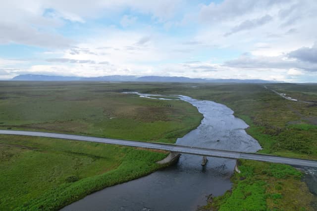
Aerial view of the Langá river near the Road 54 bridge, west Iceland.

Intimate west Iceland salmon river with small clear pools.

Tomorrow · Closed season
Forecast · Tomorrow
Closed season
Out of season. File this water for the right month.
50% projected
Conditions on the water · Tomorrow
Proxy gauge
Level
Falling
Proxy
via Norðurá
Water temp2.8°C
ClarityClearing
Weather-2°C
WindN 13 km/h
Pressure988 hPa
Rain · recent0.5 mm
Rain · ahead0.5 mm

No gauge on this water — conditions are inferred from Norðurá. The trend transfers, the absolute level does not.

Water temperature for Atlantic Salmon
Too cold
3°C est.ideal 10–16°C
0°14°28°
How to fish it · for Atlantic Salmon
When
Morning into early afternoon.
Where
Pool tails, steadier runs, and any water with pace.
Method
Fish a sensible line-and-fly combination for the height and pace of water.
Kit
13 ft #8/9 double-hander in spate, 10 ft #8 single in low water. Floating line plus a fast-sink tip. 12–15 lb fluoro tippet.
Hatch timeline · tomorrowQuiet day

Low insect activity predicted today

Evidence
Records-basedModerate confidence

Based on species-occurrence records, not local invertebrate surveys.

Salmon run timing
2024 season

Through the year
0–3 scale · October highlighted
J
F
M
A
M
J
J
A
S
O
N
D
Salmon runRun
1
2
1
Nordic SpringflyHatch
2
3
3
2
Ladoga CaddisHatch
2
3
2
Evening SedgeHatch
2
3
3
3
2
Arctic Cased CaddisHatch
1
2
2
2
1

Numbers are intensity 0 (none) to 3 (peak) — a guide, not a guarantee.

Ranked for today
Atlantic Salmon fly box
Permits & access
Permit required — see local rules.
  • Langá is highly exclusive, with very low rod numbers and advance booking essential
  • Catch-and-release expectations and strict beat management are central to the fishery.
What's coming
Plan ahead
5-day outlook
Other water nearby · 5
Gallery · 2
  1. Aerial view of the Langá river near the Road 54 bridge, west Iceland.
    The Langá near Road 54
  2. Terrain map of the venue
    Terrain map
About this water

Intimate west Iceland salmon river with small clear pools. Known for prolific grilse runs and excellent dry fly fishing. Short beats, high rod density but very productive. Volcanic bedrock underlies this river. Iceland's salmon are managed conservatively under operator and national rules — quotas, size limits and catch-and-release are widely applied; check the river's rules before fishing.

Under the surface

Langá á Mýrum runs some thirty-six kilometres out of Langavatn — a lake dammed into being by a prehistoric lava flow — down through the Borgarfjörður lowlands of west Iceland. The hard bands of lava rock that shape the country have made the river: they pen it into two handsome canyon reaches, one low on Beat 2 and a more dramatic gorge at the top on Beat 6, and between them break the flow into ninety-three named pools and runs over clean volcanic stone. The water is crystal-clear and the flow dependable, drawn steadily from the lake above. This is predominantly grilse water — bright fish of one to three kilos with the occasional heavier salmon — fished best on a floating line through the season. Wading is comparatively easy on firm rock and gravel, the canyon sections excepted, where the footing wants respect.

Wading: Uneven rock in the canyon reaches

  • River
  • Volcanic
  • Partly confined
  • Pool riffle
  • Step pool
Why this score · for Atlantic Salmon
  • Temperature030% weight
  • Flow6025% weight
  • Clarity9520% weight
  • Feeding Time9015% weight
  • Pressure8510% weight
Directions
Seasons & zones
  • Salmon 1 July → 30 September
Related guides
Booking & contacts