Freestone · Volcanic · South-West Iceland

Hvítá (Kljáfoss)

Hvítá (Kljáfoss) terrain map
Terrain map

South-West Iceland salmon river (distinct Hvítá section from Borgarfjörður).

Species

Marginal — persistence required

River dropping into shape after a lift. A short window. Work the obvious lies and move on.

50% confidence in this read
Water temperature for atlantic salmon
Cool — slow
6°C est.ideal 1014°C
0°14°28°
Why this score · for atlantic salmon
  • Temperature1530% weight
  • Flow9025% weight
  • Clarity7520% weight
  • Feeding Time1015% weight
  • Pressure8510% weight
Conditions
Regional est.
Level
Light rain recently
No gauge reading
Water temp
5.7°C
Estimated
Clarity
Clearing
Air temp
4°C
Wind
E 19 km/h
Gentle breeze
Pressure
1003 hPa
Rain · 48h
6.2 mm
Light rain
Rain · ahead
1.7 mm
No meaningful rain · next 48h

No gauge on this water — readings are regional estimates from weather, not a live gauge.

Evidence
ModelledModerate confidence

Modelled from regional ecology — no survey or occurrence data for this water yet.

How to fish it · for atlantic salmon
When
Morning into early afternoon.
Where
Pool tails, steadier runs, and any water with pace.
Method
Fish a sensible line-and-fly combination for the height and pace of water.
Kit
13 ft #8/9 double-hander in spate, 10 ft #8 single in low water. Floating line plus a fast-sink tip. 12–15 lb fluoro tippet.
Why this works
Poor — river flow is working for you, but time of day is the limiting factor today.
Through the year
0–3 scale · June highlighted
J
F
M
A
M
J
J
A
S
O
N
D
GrannomHatch
2
2
Evening SedgeHatch
2
3
3
3
2
Western Green DrakeHatch
2
2
Flav (Small Western Green Drake)Hatch
2
3
2

Numbers are intensity 0 (none) to 3 (peak) — a guide, not a guarantee.

Permits & access
Permit required — see local rules.
  • South-West section
  • Permits via local operators
  • Good alternative within South-West system.
Directions
About this water

South-West Iceland salmon river (distinct Hvítá section from Borgarfjörður). Strong runs and good fly water. Part of broader South-West Iceland salmon complex.

Under the surface

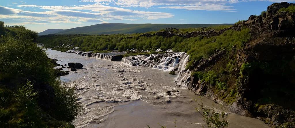
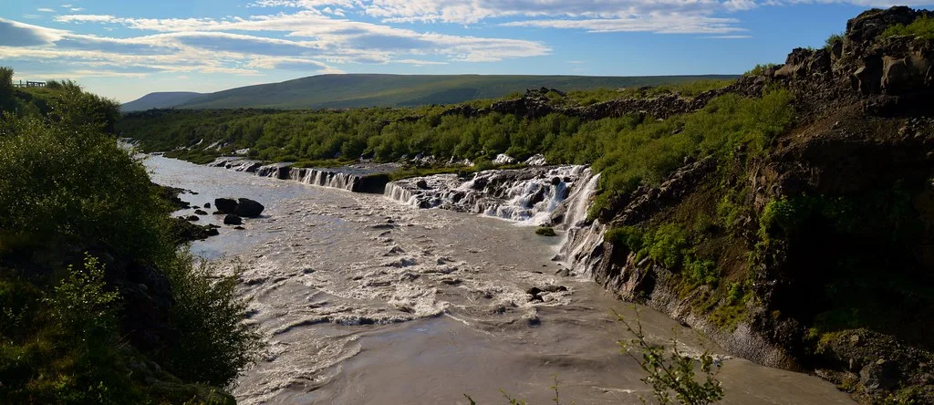
This is the great glacial Hvita of Borgarfjordur at Kljafoss — the milky white river that drains the Langjokull ice and gathers nearly every salmon river of the district before reaching the sea. At Kljafoss the main stem forces over a basalt ledge in heavy, rock-flour-pale water, a falls that long marked a limit on the salmon's passage until laddering helped open the water above. Below the lava plateau the river runs broad and strong over a shifting bed of gravel and cobble, opaque with glacial silt, on a moderate lowland gradient. The famous clear fly water lies on the tributaries that pay in — the Nordura, the Grimsa, the Thvera — while the Hvita itself is big, powerful, silted water best read by its seams, tributary mouths and the holding water below the falls. Wading the main stem is bold work in poor visibility on uncertain gravel.

Wading: Poor visibility and shifting gravel below the falls

  • River
  • Volcanic
  • Partly confined
  • Large river
Fishing better nearby · 5
Related guides